01
Mapping the Voids
The Goal:
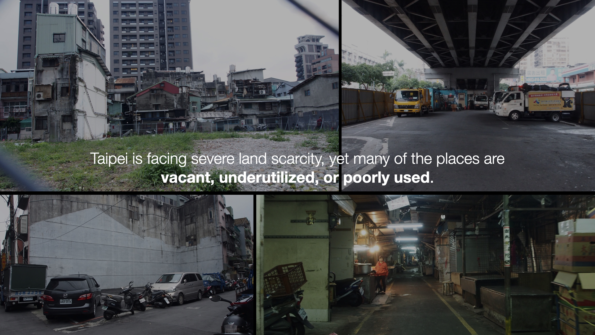
To identify and prioritize passive city spaces in Taipei with the greatest opportunity for revitalization, serving community interests and city planning needs.
The Approach & Outcome:
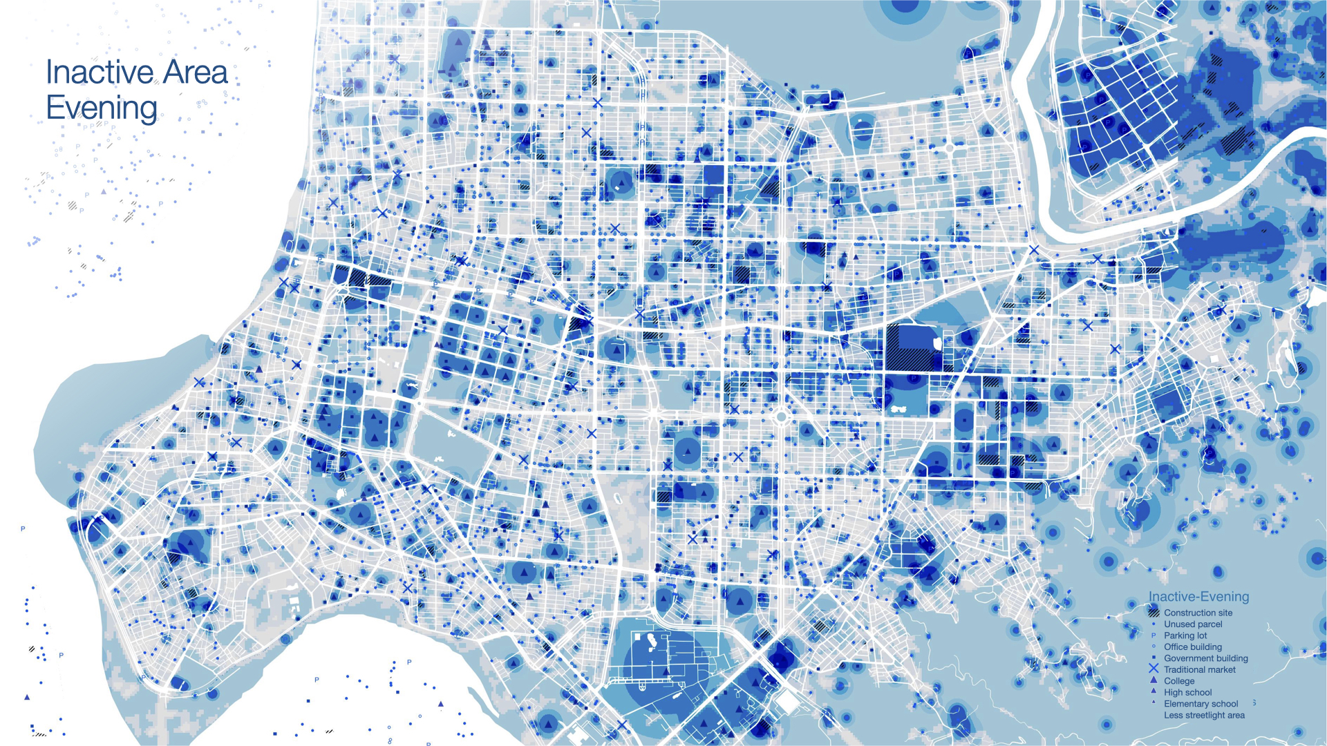
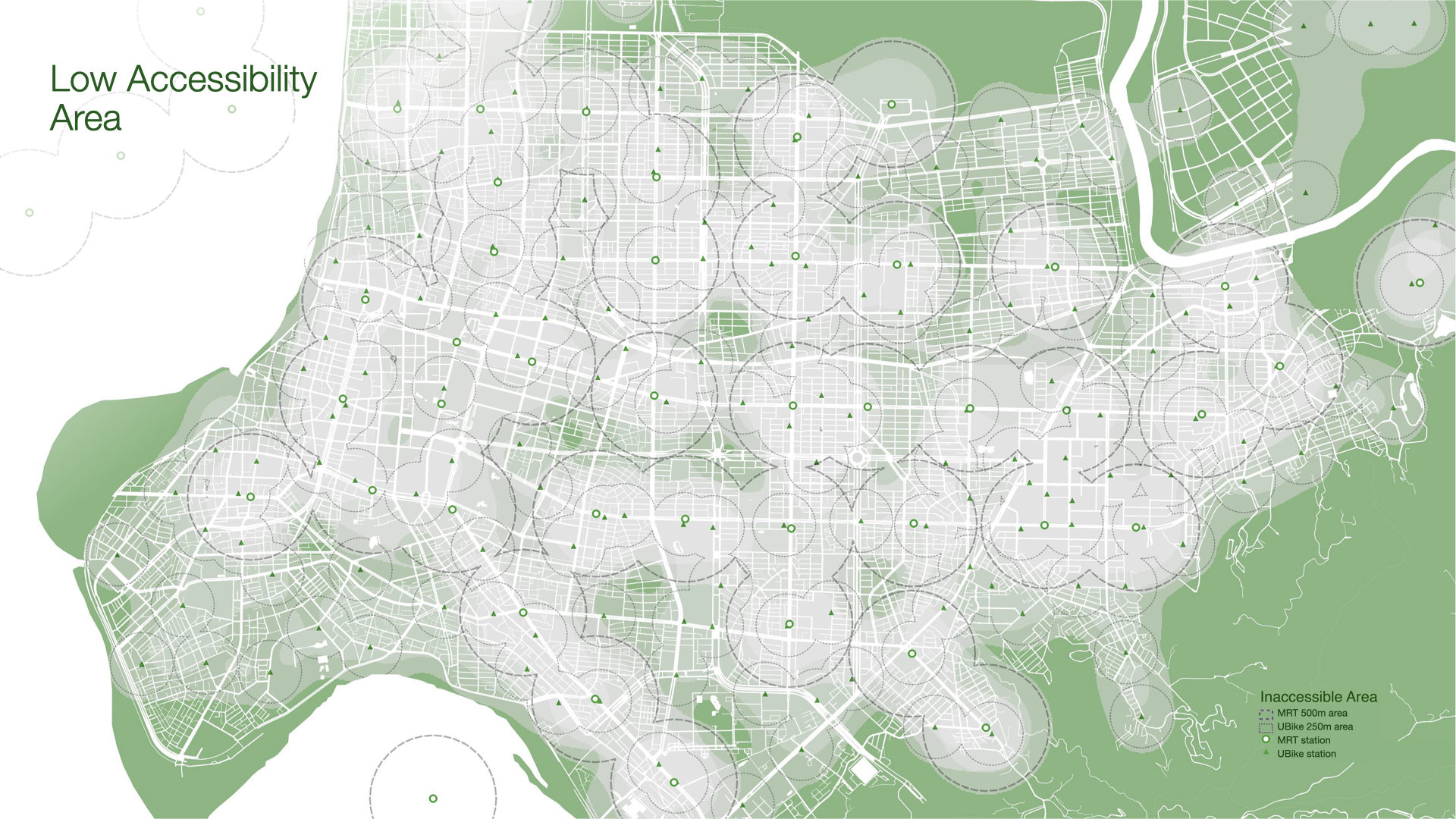
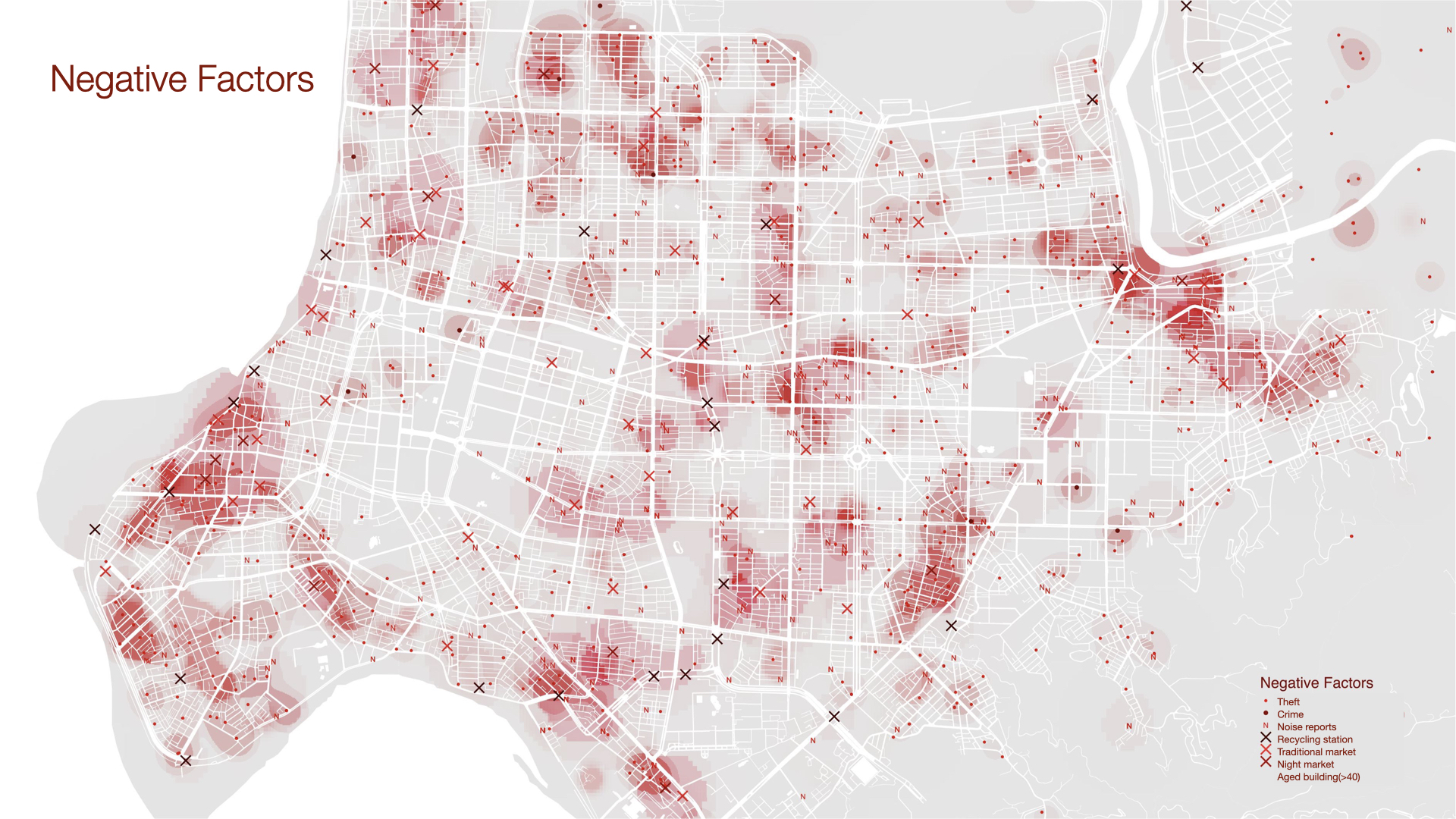
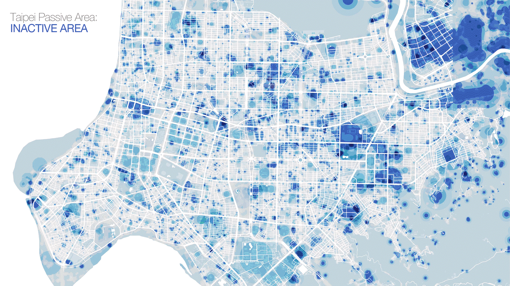
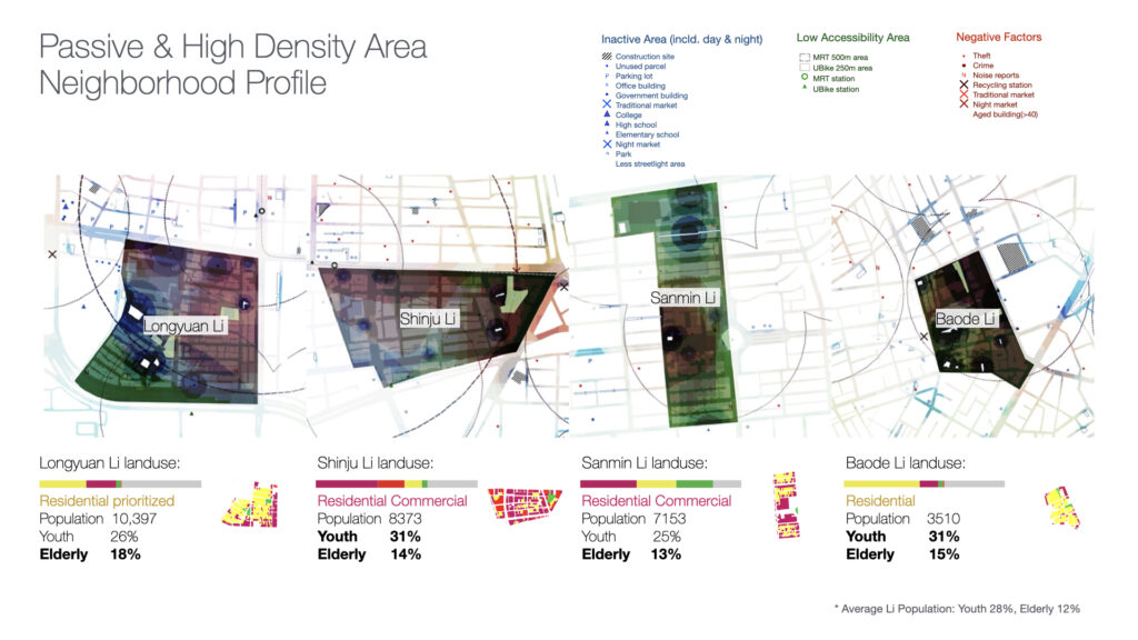
Based on open data, three categories of passive space were visualized on the Taipei map: Blue for inactive parcels; Green for poor public transit accessibility; Red for negative factors like crime hotspots. Areas to focus on were filtered by higher population densities to maximize impact potential. The visualized map helped city officials identify specific inactive parcels to implement urban regeneration programs, such as shared community amenities or elderly co-dining spaces.
Tools
QGIS / Python / Adobe Illustrator
Data Sources: Taipei City Open Data Platform (Dept. of Transportation / Police / Civil Affairs data)
Taipei, 2021
MaPping the Voids:
Passive SPACE IDENTIFICATION&Vitalization.